Hyperspectral Eyes in the Sky: Unveiling the Next Frontier in Space-Based Earth Observation
- Market Overview: The Expanding Role of Hyperspectral Imaging in Space
- Technology Trends: Innovations Driving Space-Based Hyperspectral Sensing
- Competitive Landscape: Key Players and Strategic Moves
- Growth Forecasts: Market Projections and Investment Insights
- Regional Analysis: Geographic Hotspots and Emerging Markets
- Future Outlook: Evolving Applications and Industry Trajectories
- Challenges & Opportunities: Navigating Barriers and Unlocking Potential
- Sources & References
“Imagine a satellite that not only takes pictures of Earth, but can also identify what materials compose each pixel of the image.” (source)
Market Overview: The Expanding Role of Hyperspectral Imaging in Space
Hyperspectral imaging (HSI) in space is rapidly transforming the landscape of Earth observation, offering unprecedented detail and accuracy across a wide range of applications. Unlike traditional multispectral sensors, hyperspectral sensors capture data across hundreds of contiguous spectral bands, enabling the identification and analysis of materials, vegetation, water quality, and even atmospheric gases with remarkable precision.
The global market for hyperspectral imaging in space is experiencing robust growth, driven by increasing demand for high-resolution, real-time data in sectors such as agriculture, environmental monitoring, defense, and disaster management. According to a recent report, the global hyperspectral imaging market is projected to reach USD 34.3 billion by 2028, growing at a CAGR of 18.3% from 2023 to 2028. The space-based segment is a significant contributor to this growth, fueled by advancements in sensor miniaturization, lower launch costs, and the proliferation of small satellite constellations.
Key players such as Planet Labs, Satellogic, and HySpecIQ are deploying hyperspectral satellites capable of capturing data at resolutions previously unattainable from orbit. For example, Planet Labs’ Pelican constellation aims to deliver high-frequency, high-resolution hyperspectral imagery to support applications ranging from crop health monitoring to mineral exploration.
Government agencies are also investing heavily in hyperspectral capabilities. NASA’s Hyperion instrument, launched on the EO-1 satellite, demonstrated the value of space-based HSI for over a decade, paving the way for new missions such as the EMIT (Earth Surface Mineral Dust Source Investigation) mission, which is mapping the composition of Earth’s surface minerals from the International Space Station.
- Agriculture: HSI enables precise monitoring of crop health, soil conditions, and pest infestations, supporting sustainable farming practices.
- Environmental Monitoring: Space-based HSI is critical for tracking deforestation, water pollution, and the impacts of climate change.
- Disaster Response: Rapid assessment of flood, fire, and storm damage is enhanced by the detailed spectral data provided by hyperspectral sensors.
As the technology matures and costs continue to decline, hyperspectral imaging is poised to become a cornerstone of the Earth observation market, delivering actionable insights that were previously out of reach.
Technology Trends: Innovations Driving Space-Based Hyperspectral Sensing
Space-based hyperspectral imaging is rapidly transforming the landscape of Earth observation, offering unprecedented detail and analytical power across a wide range of applications. Unlike traditional multispectral sensors, which capture data in a handful of broad wavelength bands, hyperspectral sensors collect information across hundreds of narrow, contiguous spectral bands. This enables the detection of subtle differences in surface materials, vegetation health, water quality, and even atmospheric composition.
Recent technological advancements have made hyperspectral imaging from space more feasible and cost-effective. Miniaturization of sensors, improvements in onboard data processing, and the proliferation of small satellite constellations are key drivers. For example, companies like HySpecIQ and Planet are deploying or planning hyperspectral satellites capable of delivering high-resolution, high-frequency data to commercial and government users.
- Precision Agriculture: Hyperspectral data enables farmers to monitor crop health, detect disease, and optimize resource use with greater accuracy. According to MarketsandMarkets, the global hyperspectral imaging market is projected to reach $34.3 billion by 2028, driven in part by agricultural demand.
- Environmental Monitoring: Space-based hyperspectral sensors can track harmful algal blooms, assess water quality, and monitor deforestation. The European Space Agency’s CHIME mission, set for launch in 2025, will provide critical data for climate and ecosystem studies.
- Mineral Exploration: Hyperspectral imaging can identify mineral compositions and map geological features, supporting mining and resource management. Startups like Asterra are leveraging this technology for subsurface water and mineral detection.
- Disaster Response: Rapid, detailed imaging aids in assessing damage from wildfires, floods, and hurricanes, improving emergency response and recovery efforts.
As launch costs decrease and data analytics capabilities expand, the integration of artificial intelligence and machine learning is further enhancing the value of hyperspectral data. These innovations are making it possible to deliver actionable insights in near real-time, revolutionizing how governments, businesses, and researchers observe and manage the planet. The next decade is poised to see hyperspectral “eyes in the sky” become a cornerstone of global Earth observation infrastructure (SpaceNews).
Competitive Landscape: Key Players and Strategic Moves
The competitive landscape for space-based hyperspectral imaging is rapidly evolving, driven by technological advancements and increasing demand for high-resolution, multi-band Earth observation data. Hyperspectral imaging satellites capture information across hundreds of spectral bands, enabling detailed analysis of land, water, and atmospheric conditions. This capability is transforming industries such as agriculture, mining, environmental monitoring, and defense.
Key Players
- Planet Labs: Known for its large fleet of Earth observation satellites, Planet Labs is expanding into hyperspectral imaging with its Pelican and Tanager missions, aiming to provide high-frequency, high-resolution hyperspectral data for commercial and government clients.
- Satellogic: This Argentina-based company is deploying a constellation of satellites equipped with hyperspectral sensors, targeting applications in agriculture, forestry, and infrastructure monitoring. In 2023, Satellogic announced partnerships to expand its data analytics capabilities (Satellogic Newsroom).
- Cosine (HyperScout): Cosine’s HyperScout instruments are flying on several European satellites, providing real-time hyperspectral data for disaster response and environmental monitoring (Cosine News).
- Maxar Technologies: While traditionally focused on high-resolution optical imagery, Maxar is investing in advanced spectral imaging and analytics, positioning itself for future hyperspectral offerings (Maxar Newsroom).
- European Space Agency (ESA): ESA’s FLEX mission, scheduled for launch in 2025, will provide hyperspectral data to monitor vegetation health globally.
Strategic Moves
- Partnerships and M&A: Companies are forming alliances to integrate hyperspectral data with AI-driven analytics. For example, Planet Labs’ acquisition of VanderSat in 2021 enhanced its capabilities in water and soil monitoring (Planet-VanderSat).
- Vertical Integration: Firms are developing end-to-end solutions, from satellite manufacturing to data analytics, to capture more value and differentiate offerings.
- Government Contracts: Agencies like NASA and the European Commission are awarding contracts for hyperspectral missions, fueling R&D and commercial deployments (NASA Hyperspectral Mission).
As the market matures, competition is intensifying, with new entrants and established players racing to deliver actionable insights from hyperspectral “eyes in the sky.”
Growth Forecasts: Market Projections and Investment Insights
Space-based hyperspectral imaging is rapidly transforming the Earth observation (EO) market, offering unprecedented detail across hundreds of spectral bands. This technology enables applications ranging from precision agriculture and mineral exploration to environmental monitoring and defense. The global hyperspectral imaging market, valued at approximately USD 16.8 billion in 2023, is projected to reach USD 34.3 billion by 2028, growing at a CAGR of 15.2%.
- Market Drivers: The surge in demand for high-resolution, real-time data is propelling investment in hyperspectral satellites. Governments and private players are leveraging this data for climate change monitoring, disaster response, and resource management. The commercialization of EO data is also fueling growth, with startups like HySpecIQ and Planet Labs launching dedicated hyperspectral constellations.
- Investment Trends: Venture capital and government funding are accelerating. In 2023, EO startups raised over USD 1.2 billion, with a significant portion directed toward hyperspectral capabilities. The European Space Agency’s CHIME mission and NASA’s Hyperion instrument exemplify public sector commitment.
- Regional Outlook: North America leads in market share, but Asia-Pacific is the fastest-growing region, driven by investments from China and India. The Asia-Pacific hyperspectral imaging market is expected to reach USD 7.2 billion by 2032.
- Future Projections: By 2030, analysts predict over 100 hyperspectral satellites in orbit, delivering petabytes of data daily (Euroconsult). This data deluge will drive demand for advanced analytics and AI-powered interpretation, opening new investment opportunities in downstream services.
In summary, hyperspectral imaging from space is set to revolutionize EO, with robust growth forecasts and strong investor interest. As satellite costs fall and analytics mature, the sector is poised for exponential expansion, reshaping how industries and governments monitor and manage the planet.
Regional Analysis: Geographic Hotspots and Emerging Markets
Space-based hyperspectral imaging is rapidly transforming the landscape of Earth observation, with certain geographic regions emerging as key hotspots for both technological innovation and market adoption. Hyperspectral sensors, which capture data across hundreds of spectral bands, enable unprecedented insights into agriculture, forestry, mineral exploration, environmental monitoring, and defense applications. The global hyperspectral imaging market is projected to reach USD 34.3 billion by 2028, with a significant portion driven by satellite-based platforms.
- North America: The United States leads in both the deployment of hyperspectral satellites and the commercialization of downstream analytics. NASA’s HyspIRI and the ECOSTRESS missions, along with private ventures like Planet Labs and HySpecIQ, are driving innovation. The U.S. government’s increasing investment in climate monitoring and precision agriculture is fueling demand for high-resolution hyperspectral data.
- Europe: The European Space Agency (ESA) is a major player, with missions such as CHIME (Copernicus Hyperspectral Imaging Mission for the Environment) set to launch in 2025. European startups like KOMPSAT and OroraTech are also advancing commercial applications, particularly in environmental monitoring and disaster response.
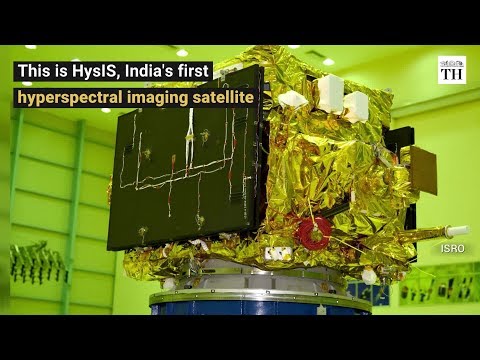
- Asia-Pacific: China and India are rapidly expanding their hyperspectral capabilities. China’s GF-5 satellite series and India’s HySPEX missions are enhancing regional capacity for resource management and urban planning. The Asia-Pacific market is expected to grow at a CAGR of over 12% through 2028 (Research and Markets).
- Emerging Markets: Latin America and Africa are beginning to leverage hyperspectral data for agriculture and environmental protection. Initiatives like AgroSpace in Brazil and partnerships with international agencies are helping to democratize access to advanced Earth observation technologies.
As satellite launches become more affordable and data analytics mature, hyperspectral imaging is poised to become a cornerstone of global Earth observation, with regional leaders shaping the future of this transformative technology.
Future Outlook: Evolving Applications and Industry Trajectories
Hyperspectral imaging from space is rapidly transforming the landscape of Earth observation, offering unprecedented detail and analytical power across a spectrum of industries. Unlike traditional multispectral sensors, hyperspectral systems capture data in hundreds of contiguous spectral bands, enabling the detection of subtle material differences and chemical compositions on the Earth’s surface. This technological leap is driving a new era of applications and market growth.
According to recent market research, the global hyperspectral imaging market is projected to reach USD 34.3 billion by 2028, growing at a CAGR of 18.3% from 2023. The surge is fueled by the increasing deployment of hyperspectral payloads on satellites, with both government and commercial operators investing in next-generation constellations. Companies like Planet Labs and HySpecIQ are at the forefront, launching dedicated hyperspectral satellites to deliver high-resolution, high-frequency data streams.
- Agriculture: Hyperspectral data enables precision farming by monitoring crop health, detecting disease, and optimizing resource use. This leads to higher yields and reduced environmental impact (NASA).
- Environmental Monitoring: The technology is pivotal in tracking deforestation, mapping water quality, and assessing natural disasters. For example, hyperspectral sensors can identify harmful algal blooms and oil spills with greater accuracy than conventional methods (NASA Earth Observatory).
- Mineral Exploration: Mining companies leverage hyperspectral imagery to pinpoint mineral deposits and reduce exploration costs, accelerating the discovery process (Geospatial World).
- Urban Planning and Infrastructure: Urban analysts use hyperspectral data to monitor land use changes, assess building materials, and support smart city initiatives (MDPI).
Looking ahead, the integration of artificial intelligence and cloud-based analytics is expected to further unlock the value of hyperspectral data, making insights more accessible and actionable. As launch costs decrease and sensor technology advances, the proliferation of hyperspectral satellites will democratize access to high-fidelity Earth observation, catalyzing innovation across sectors and supporting global sustainability goals.
Challenges & Opportunities: Navigating Barriers and Unlocking Potential
Hyperspectral imaging from space is rapidly transforming the landscape of Earth observation, offering unprecedented detail across hundreds of spectral bands. This technology enables the detection of subtle changes in vegetation health, mineral composition, water quality, and even urban infrastructure, far surpassing the capabilities of traditional multispectral sensors. However, the path to widespread adoption is marked by both significant challenges and promising opportunities.
- Technical Barriers: Hyperspectral sensors generate massive volumes of data—often terabytes per day per satellite. This creates bottlenecks in data transmission, storage, and processing. Advanced onboard compression and edge computing are being developed to address these issues, but the need for robust ground infrastructure remains a hurdle (NASA).
- Cost and Accessibility: Building, launching, and operating hyperspectral satellites is expensive. While the cost of small satellites is decreasing, high-resolution hyperspectral payloads still require significant investment. This limits access primarily to government agencies and large corporations, though commercial players like Planet Labs and Hypercube are working to democratize access.
- Data Interpretation: The complexity of hyperspectral data demands advanced analytics and machine learning for meaningful interpretation. There is a shortage of skilled professionals and standardized tools, which slows the translation of raw data into actionable insights (MDPI).
Despite these barriers, the opportunities are vast:
- Environmental Monitoring: Hyperspectral imaging enables early detection of crop diseases, forest degradation, and water pollution, supporting sustainable resource management and disaster response (NASA Earth Observatory).
- Commercial Applications: Industries such as mining, agriculture, and insurance are leveraging hyperspectral data for mineral exploration, precision farming, and risk assessment, unlocking new revenue streams (Geospatial World).
- Policy and Compliance: Governments can use hyperspectral data to monitor environmental compliance, enforce regulations, and track progress toward climate goals (ESA EnMAP).
As technology matures and costs decline, hyperspectral imaging is poised to become a cornerstone of Earth observation, offering both societal and commercial benefits while driving innovation across multiple sectors.
Sources & References
- Hyperspectral Eyes in the Sky: How Space-Based Imaging Is Revolutionizing Earth Observation
- USD 34.3 billion by 2028
- Planet Labs
- Satellogic Newsroom
- Hyperion
- NASA
- HySpecIQ
- ESA EnMAP
- Asterra
- commercialization of EO data
- Cosine News
- Maxar Newsroom
- USD 1.2 billion
- Asia-Pacific hyperspectral imaging market
- Euroconsult
- ECOSTRESS
- KOMPSAT
- OroraTech
- GF-5
- HySPEX
- Research and Markets
- NASA Earth Observatory
- Geospatial World
- Hypercube